


HuKi is a hiking app for hikers and outdoor enthusiasts, built around Hungary's hiking trail network and its traditional trail markers. Its goal is to promote the exploration of Hungary's natural beauty while serving as a helpful companion on our adventures. HuKi is free, ad-free, and open-source software.


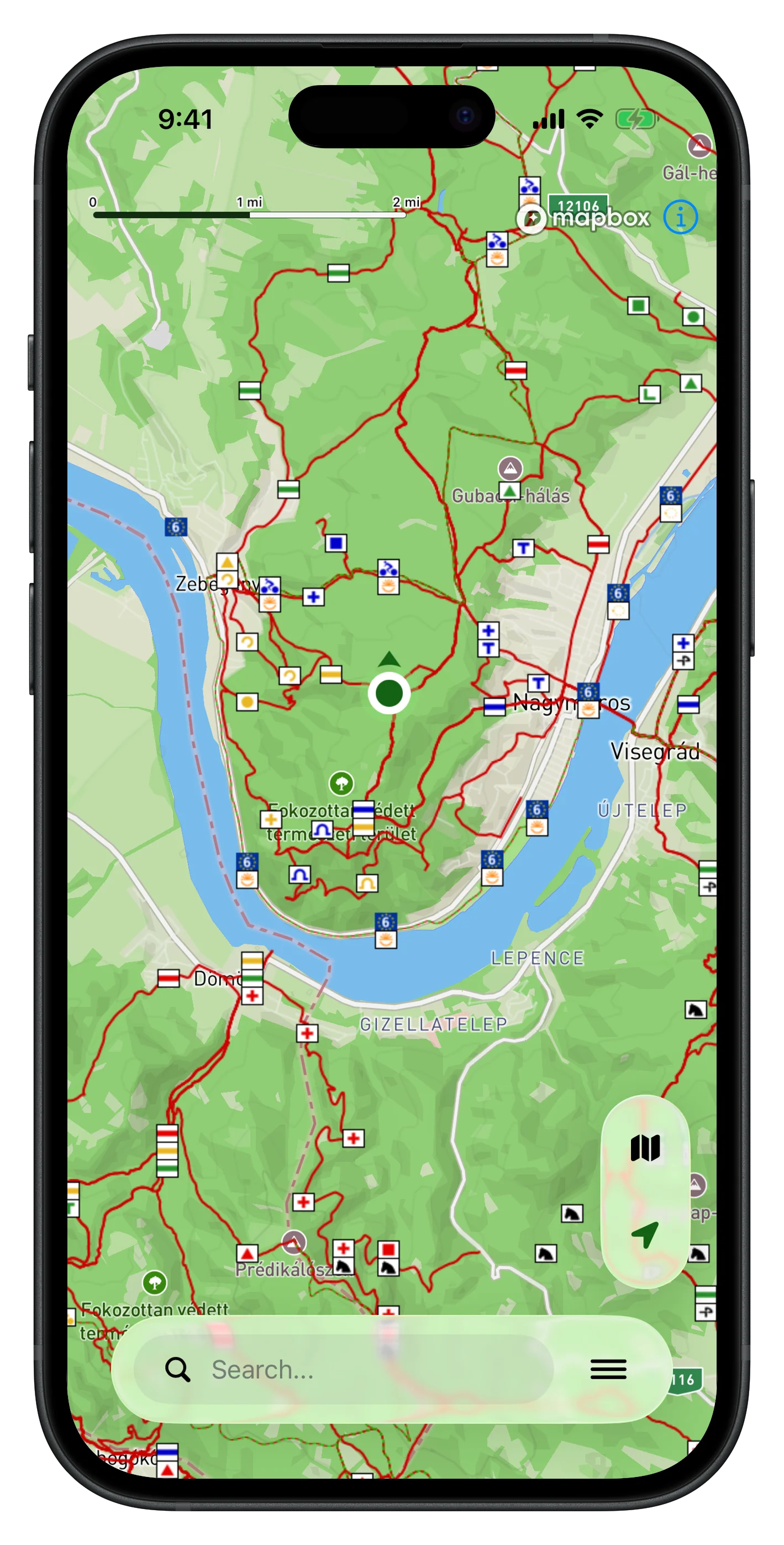
The application uses the classic Hungarian Hike layer with the national hiking trails, which is integrated with the base map.

The application has several base map layers, such as Mapnik, OpenTopo, TuHu, Google Satellite, Merretekerjek.hu.

With the route planner, we can plan routes on hiking trails. The application estimates the length and time of the tour and creates a GPX file.

With HuKi, GPX files can be imported and displayed on the map. The app provides distance, time estimation, and elevation coloring.

HuKi shows the hungarian landscapes on a map view, with their associated popular excursion places and hiking collections.

For blue trail hikers, a feature is available where the OKT, RPDDK, AKT blue rail sections and stamp locations can also be viewed.

Frequently Asked Questions
Yes, HuKi can now be downloaded from the App Store for iPhone. The iOS version is built on a completely new platform, so its features will follow those of the Android version step by step.
It has a cache based offline mode. Every loaded map tile is placed in a 14-day database that can be used offline. In my experience, this method covers most cases: in the parking lot or during a hike, there is almost always enough internet to download the necessary tiles, so we don't even notice momentary interruptions.
Many of you have asked for this, so it is definitely a priority. With the current raster rendering engine, this would not be very efficient, as it would require downloading several GB of data for the entire map of Hungary. I am considering several solutions, such as smaller area-based downloads or using a vector rendering engine.
I develop the application as a hobby in my free time and I am particularly happy to receive personal feedback, my goal is for the app to be useful to others too!